
PAL MAPS | PROFESSIONAL WEB GIS PLATFORM
Explore Cyprus like never before
Instantly access cadastral maps, planning zones, historical aerial imagery, geological data, terrain models and professional GIS tools, all from a single interactive platform.
A closer look
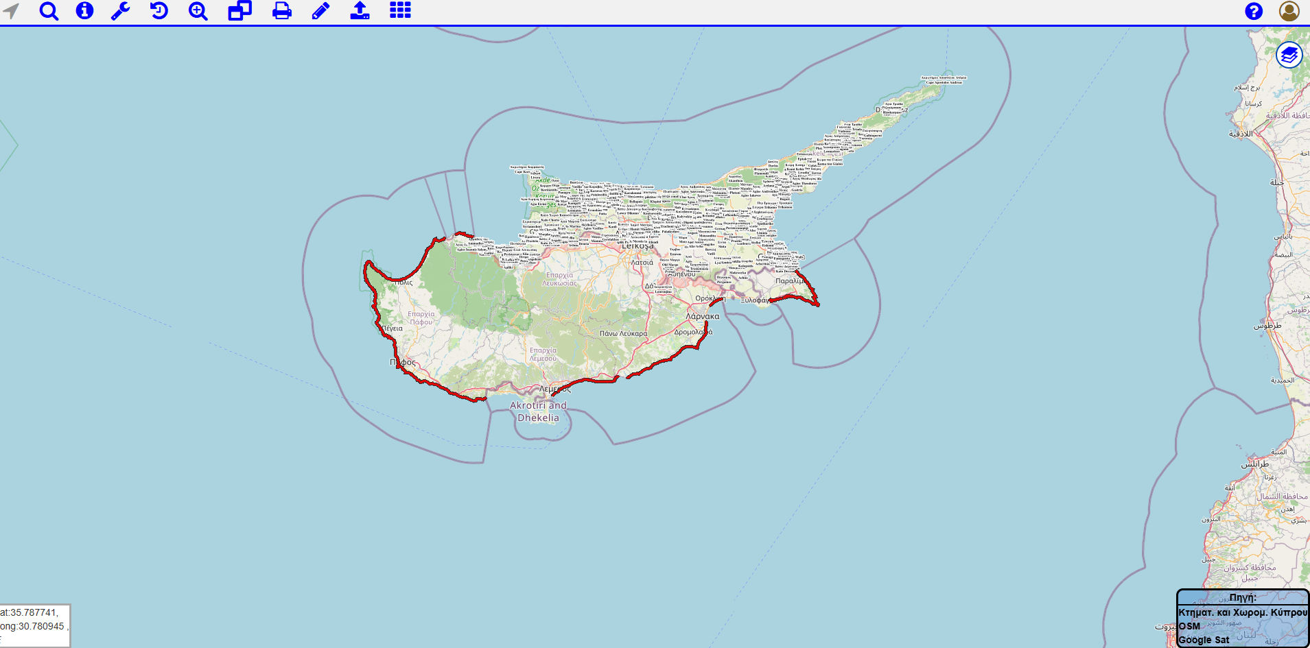
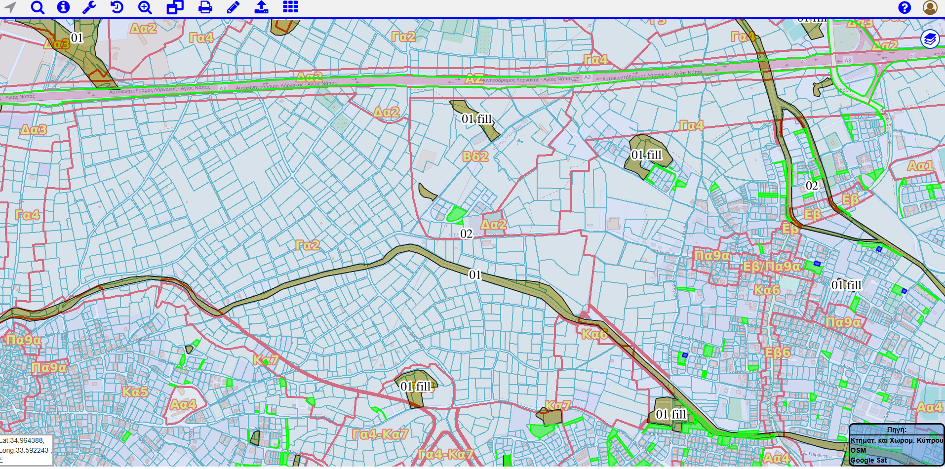
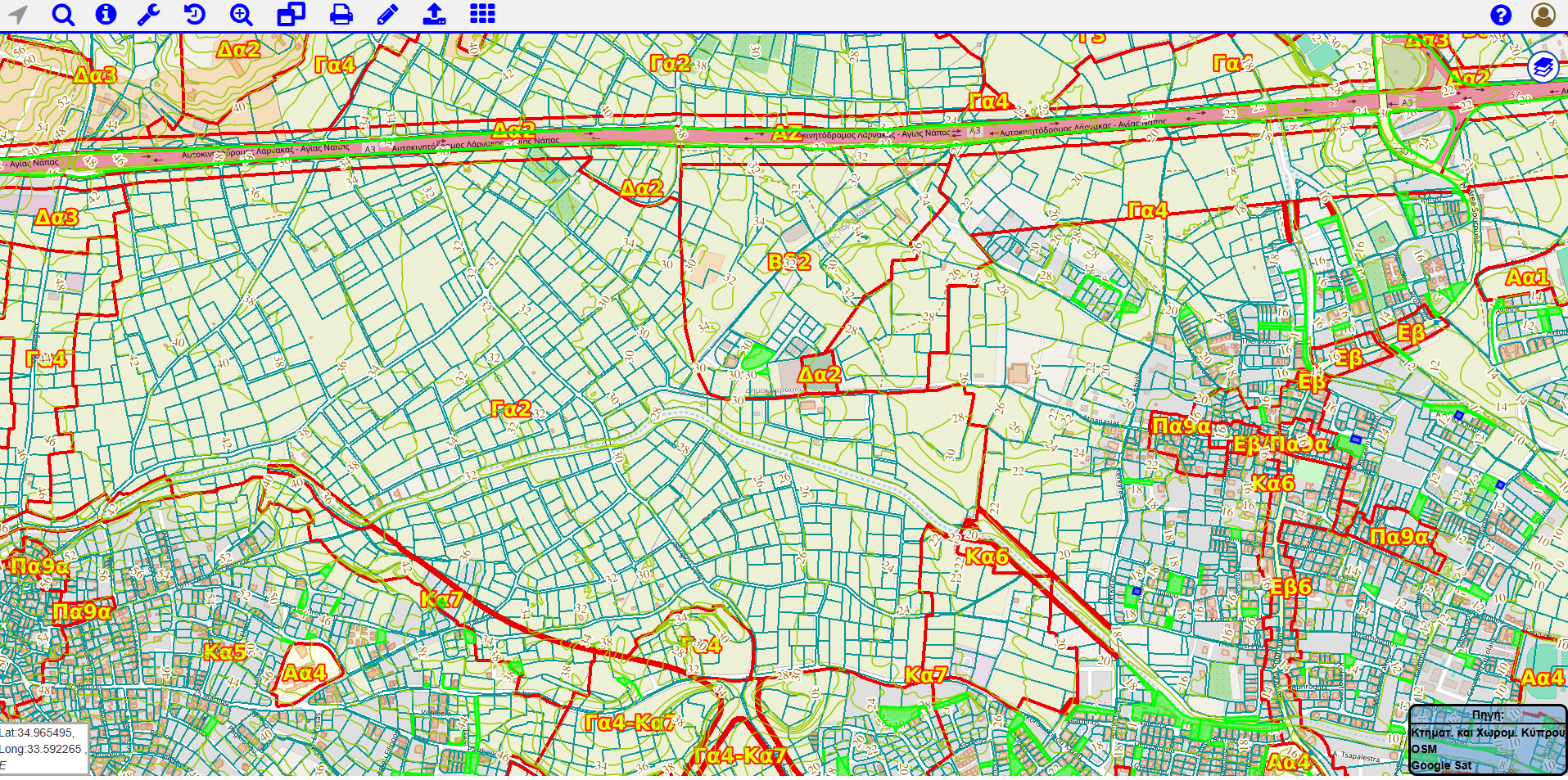
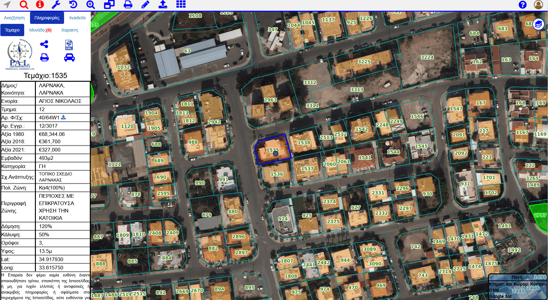
What's inside PAL Maps
20+ map layers
Cadastral, planning, environmental and utility data.
Imagery 1963 to 2019
Four epochs of historical aerial orthophotos.
All-Cyprus coverage
Cadastral parcels and buildings nationwide.
Government datasets
Official planning, geological and cadastral data.
Powerful tools, built in
Parcel search
Find any parcel by address, property ID or cadastral reference in seconds.
Historical orthophotos
Compare aerial imagery from 1963 to 2019 to see how a site has changed.
Measurements
Measure areas and distances straight from your browser.
Import & export
Import GeoJSON, DXF and KML, and export your selection to KML/KMZ.
Planning & zoning
See town-planning zones, coefficients and restrictions for any parcel.
Share & official maps
Share a direct link to any parcel or view, and download the official cadastral map.
Everything the platform can do
Search & property
- Search by address, property ID or cadastral data
- Parcel & ownership information
- Assessed value & building coefficient
- Save and revisit previous searches
- Share a direct link to a parcel or view
- Find a parcel by number in the current view
Planning & zoning
- Town-planning zones
- White zones
- Listed (preserved) buildings
- Green & community-facility spaces
- State land
- Administrative boundaries
Environmental & risk
- Geological suitability zones
- Seismic zones
- Flood zones
- Dam protection zones
- Coastal protection zone
- Natura 2000 & bird corridors
Surveying tools
- Distance & area measurements
- Drawing tools
- Import GeoJSON, DXF & KML
- Export to KML / KMZ
- Download the official cadastral map
- Contour lines & survey plan sheets
Base maps & imagery
- Historical orthophotos: 1963, 1993, 2014, 2019
- Google, Bing & Esri satellite imagery
- Road & topographic maps
- Cadastral parcels & buildings
- High-voltage power lines & postal codes
- Blank base for clean exports
Who uses PAL Maps?
Property owners
Surveyors
Developers
Lawyers
Architects
Government authorities
Civil engineers
Environmental consultants
Real-world use cases
Before buying land
Check planning restrictions, geological conditions and surrounding development before you commit.
Before designing
Review terrain, neighbouring parcels and infrastructure to inform your design.
During construction
Access survey data directly from site on a tablet or mobile phone.
Project management
Share interactive maps with your team instead of large CAD files.
Why professionals choose PAL Maps
- Built by licensed land surveyors
- Continuously updated datasets
- Designed for professional use
- Accessible from any device
- No software to install
- Supports engineering workflows
Not just a map, a full GIS platform
PAL Maps is built on professional GIS technology. Depending on the project, we integrate and serve a wide range of spatial data and services:
- Drone photogrammetry & orthophotos
- 3D point clouds
- SLAM laser scanning
- Custom WMS services
- GeoServer-based layers
- Historical imagery
- Planning & geological layers
- 3D models & terrain
- Private client GIS portals
This is the same technology behind our professional surveying services and the custom Web GIS solutions we build for organisations — for example, our recent 3D digital twin of Aphrodite Hills resort.
How PAL Maps compares
| Capability | PAL Maps | Typical online maps |
|---|---|---|
| Professional GIS layers | ✓ | Basic roads only |
| Cadastral parcel data | ✓ | ✗ |
| Planning zones | ✓ | ✗ |
| Geological & flood data | ✓ | ✗ |
| Historical orthophotos (1963-2019) | ✓ | ✗ |
| Import GeoJSON / DXF / KML | ✓ | ✗ |
| Measurement tools | ✓ | Limited |
Need your own GIS platform?
Beyond the public platform, we build bespoke Web GIS solutions for organisations, including private project portals, asset and infrastructure mapping, construction monitoring and custom GIS applications.
Ready to explore Cyprus like never before?
Launch PAL Maps in your browser, or talk to our GIS team about a solution for your organisation.